| Description |
|
| |
|
|
|
|
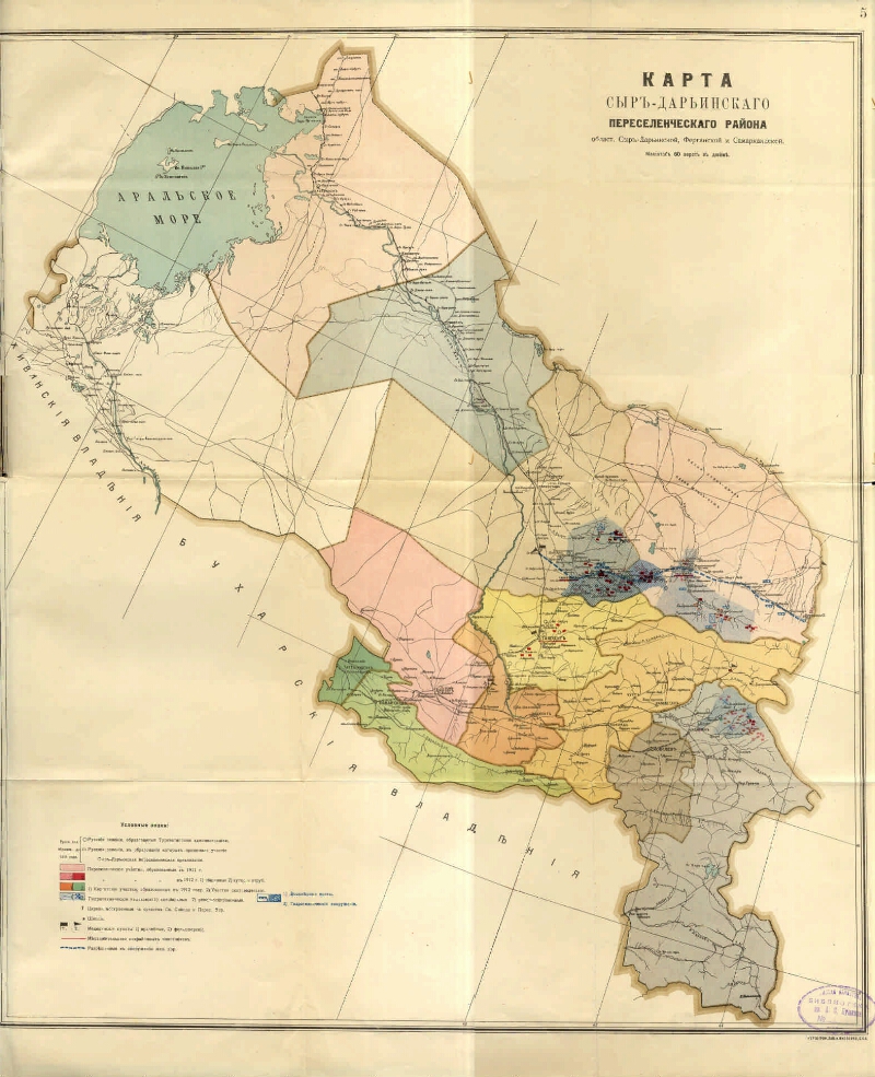
Map of the Syr-Darya resettlement region. Syr-Darya, Fergana and Samarkand [Maps]. - [1: 252 000], 60 versts in inch (2, 5 km in 1 cm). - SPB : The cartographer. head. A. Yakovenko, [after 1910]. - 1 in.: Color. ; 62x61 (68x69). - Cartographer. grid through 2 °. - Installed. debt. from Pulkovo. - Without relief. - Usl. signs: the land of cities and rus. settlements, rus. villages (2 species), Kirghiz. plots, hydraulic engineering. research, honey. points, etc.
.
|
|
|
|
1. Territory of Russia (collection). 2. Syrdarya region (Uzbekistan) - Geography - beginning. 20 cent. - Maps. 3. Geographic maps. |
|
|
ББК 26.89 (543) я64
|
|---|
|
|
Source of electronic copy: Omsk GONB
Location on
Omskaya GONB
|
|