|
|
|
|
|
A collection of historical and statistical information about Siberia and its neighboring countries
. - St. Petersburg, 1875-1876
|
|
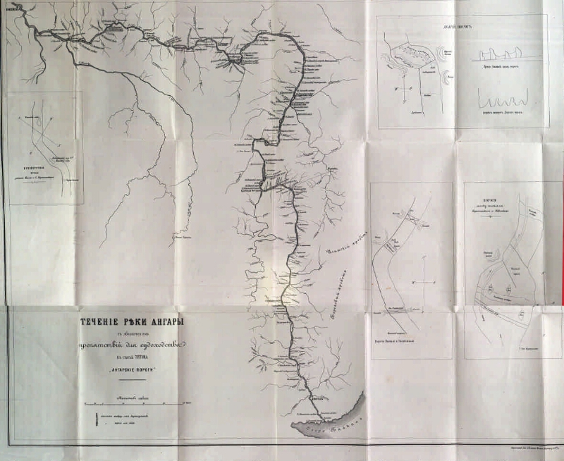
The current of the Angara River with the designation of obstacles to navigation [Maps]: to the article of Titov "Angarsk rapids". - 1: 1 680 000, 40 versts in 1 inch. - Additional. maps: Obstacles between the mouth of the Elim and the. Karapchansky; Thresholds Drunk and hangover; The thresholds between the villages of Karapchansk and Nevon; Long threshold
.
|
|
|
|
1. Territory of Russia (collection). 2. Angara River (Eastern Siberia) - Pool - Maps. 3. Geographic maps. |
|
|
BBK 26.89 (285.4) i64
|
|---|
|
|
Source of electronic copy: Irkutsk OGUNB
Location on the original: Иркутская ОГУНБ
|