| Description |
|
| |
|
|
|
|
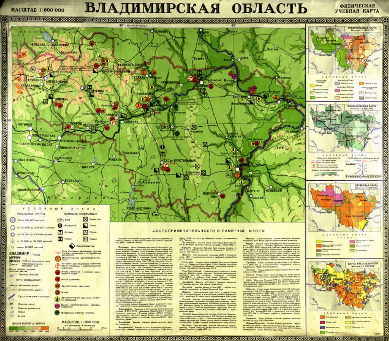
Vladimir region [Maps]: physical training map / comp. F-koy No. 2 in 1972; Ed. S.N. Gerasimova. - 1: 600 000, 6 km in 1 cm, heights in m. - Moscow: Main Department of Geodesy and Cartography under the Council of Ministers of the USSR, 1972. - 1 room.: Color., 4 ext. maps, text; 50 x 72. - [Debt] from Greenwich. - On the map brand: I-1720. - Additional. maps: Geological map. 1: 2,400,000; Climate map. 1: 2,400,000; Soil map. 1: 2,400,000; Map of vegetation. 1: 2 400 000. - Text: Attractions and points of interest
.
|
|
|
|
1. Vladimir Region - Historical Geography. 2. Physical maps. 3. Geographic maps. |
|
|
ББК 63.3 (2Рос-4Вла) 633я64
|
|---|
|
|
The source of electronic copy: Vladimir OUNB
The original storage: Владимирская ОУНБ
|
|