| Description |
|
| |
Stremkrona, Niels Torverson
(1664-1740).
|
|
|
|
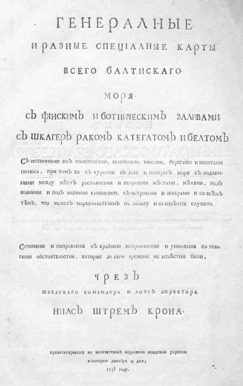
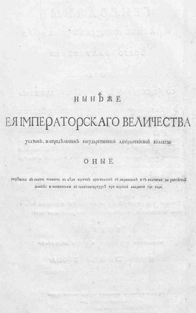
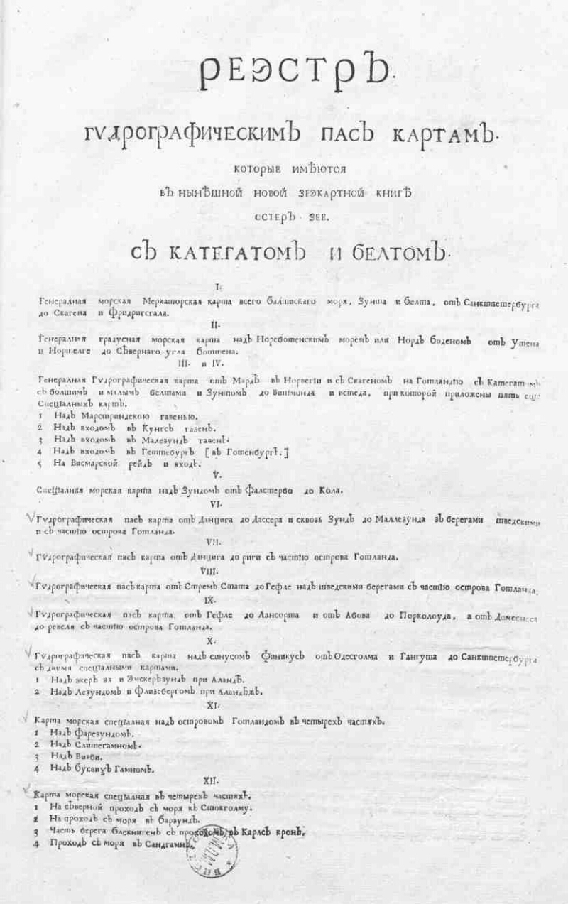
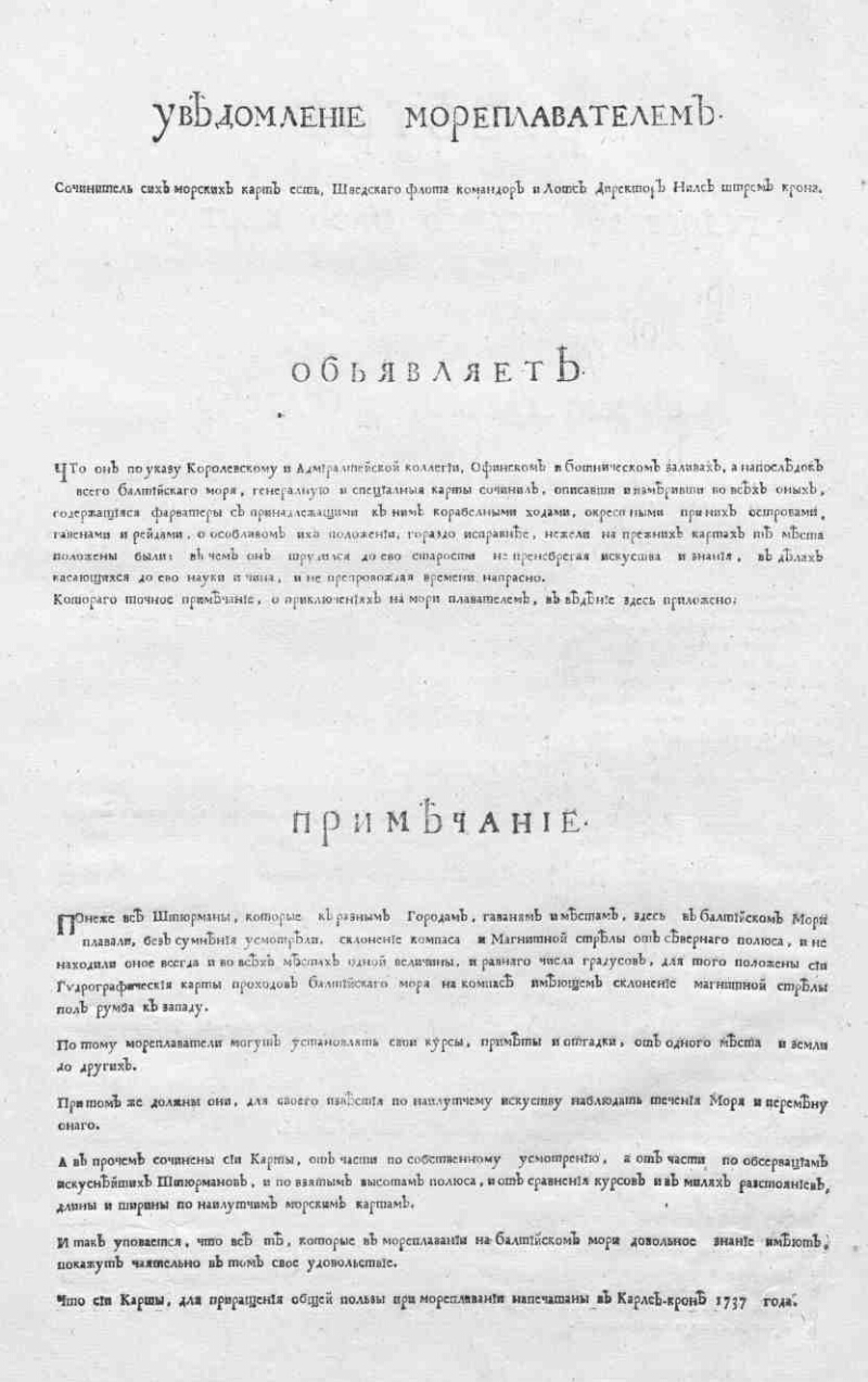
General and various special maps of the entire Baltic Sea. : With the Finnish and the Bothnic Gulfs. With Shager the cancer of Kathegat and Belt with their true positions, size, capes, shores and pole heights, with the same courses in the sea and across the sea with genuine between places distances and anchorage places, chutes, over water and under water stones, with islands and the skerries, and with all that the seafarer can do for the good and the news to serve. / Wrote and corrected with utmost serviceability and multiplied with many circumstances, which until now were not known. Through the Swedish commander and Lots director Nils Strem Krone. ; Privileged by her Majesty the Queen of Sweden, Ulrica Eleonora, December 19, 1738. The day of her Imperial Majesty, by decree and the definition of the State Admiralty College, they were carved into the most exactitude on copper against the originals with translation and inscriptions in Russian, and printed in St. Petersburg at the Maritime Academy in 1750. - [Sankt-Petersburg]: [Nopech. when Mor. Acad.], [1750]. - [4] p., 11 liters. kart. ; 2 °. - All cards, except for 3-5, have an instruction: It was translated carefully from the Swedish language to Russian, and corrected by the works of the fleet of Captain Alexei Nagaev. - 12 cards are placed on 11 pages. - SK XVIII
.
|
|
|
|
1. The Baltic Sea - Geographic maps. 2. Geographic maps. |
|
|
BBK 26.89 (92)
|
|---|
|
|
Source of electronic copy: РГБ
Location on
archive: РГБ
|
|