Water resources
Water resources
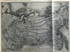
Opening and freezing of waters in Asian Russia (1907) // Izvestia of the East Siberian Division of the Russian Geographical Society. 1906, P. 37: Materials for climatology of Asian Russia / VB Shostakovich
Russian Geographical Society. East-Siberian department
Izvestiya of the East Siberian Division of the Russian Geographical Society. Opening and freezing of waters in Asian Russia (until 1907). Location: Irkutsk, 1870-.
1906
Иркутская ОГУНБ
- Amur
The Atlas of the mouth of the Amur River, compiled from the filming of 1855-1863, at the Hydrographic Department
The Atlas of the mouth of the Amur River, compiled from the filming of 1855-1863, at the Hydrographic Department. [St. Petersburg], 1864. - Angara
The course of the Angara River with a designation of obstacles to navigation // A collection of historical and statistical information about Siberia and its neighboring countries. T. 1, vol. 2, 1875
A collection of historical and statistical information about Siberia and its neighboring countries. The current of the Angara River with the designation of obstacles to navigation. Film St. Petersburg, 1875-1876.Map of the flow of the rivers Ilim and the Angara // Izvestiya of the East Siberian Division of the Russian Geographical Society. 1883 T. 14, No. 3 (1883)
Russian Geographical Society. East-Siberian department Izvestiya of the East Siberian Division of the Russian Geographical Society. Map of the flow of the rivers Ilima and Angara. Location: Irkutsk, 1870-.Long - threshold map. Fishing for red fish on the river. Angara
Map of the Long Threshold.
Map of the Shaman threshold. Fishing for red fish on the river. Angara
Map of the Shaman threshold.
Map of the river. Angara //. Fishing for red fish on the river. Angara
Map of the river. Hangars. - Verkhyaya Angara
Map of the Upper Angara River flow from selenium. Upper Angarsk to its origins was compiled in 1888 by NI Grigorovsky // News of the East Siberian Division of the Russian Geographical Society. Vol.21, No. 2, 1890
Russian Geographical Society. East-Siberian department Izvestiya of the East Siberian Division of the Russian Geographical Society. Map of the Upper Angara River flow from selenium. Upper Angarsk to its origins was compiled in 1888 by NI Grigorovsky. Location: Irkutsk, 1870-. - Ilim
Map of the flow of the rivers Ilim and the Angara // Izvestiya of the East Siberian Division of the Russian Geographical Society. 1883 T. 14, No. 3 (1883)
Russian Geographical Society. East-Siberian department Izvestiya of the East Siberian Division of the Russian Geographical Society. Map of the flow of the rivers Ilima and Angara. Location: Irkutsk, 1870-. - Kirenga
- Kuban
- Neva
Map of the mouth of the river. Neva in the city of St. Petersburg
Map of the mouth of the river. Neva in the city of St. Petersburg. 1839. - Neman
Grodno Province. The project of strengthening the Neman River in the mountains. Grodno
Russia. Ministry of the Interior. Technical and Construction Committee. Grodno Province. The project of strengthening the Neman River in the mountains. Grodno. 1890. - Nizhnyaya Tunguska
Map of the river. Lower Tunguska and part of the river. Olenek on the basis of the latest astronomical definitions, routes and questions / / News of the Russian Geographical Society. T. 12 1876, vol. 5
Russian Geographical Society. News of the Russian Geographical Society. St. Petersburg: Science, St. Petersburg Branch, 1865-. Map of the river. Lower Tunguska and part of the river. Olenek on the basis of the latest astronomical definitions, routes and inquiries. - Olenyok
Map of the river. Lower Tunguska and part of the river. Olenek on the basis of the latest astronomical definitions, routes and questions / / News of the Russian Geographical Society. T. 12 1876, vol. 5
Russian Geographical Society. News of the Russian Geographical Society. St. Petersburg: Science, St. Petersburg Branch, 1865-. Map of the river. Lower Tunguska and part of the river. Olenek on the basis of the latest astronomical definitions, routes and inquiries. - Sarma
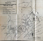
Map of part of the north-western Baikal region along the valleys of the rivers Ungury, Sarma and Av. Ilikty // Izvestiya of the East Siberian Department of the Russian Geographical Society. 1897 T. 28, No. 1
Russian Geographical Society. East-Siberian department Izvestiya of the East Siberian Division of the Russian Geographical Society. Map of part of the north-western Baikal region along the valleys of the rivers Ungury, Sarma and Av. Illicities. Location: Irkutsk, 1870-. - Selenga
Map of the Selenga delta // Izvestiya of the East Siberian Division of the Russian Geographical Society. 1897 T. 28, No. 1
Russian Geographical Society. East-Siberian department Izvestiya of the East Siberian Division of the Russian Geographical Society. Map of the delta of the Selenga River. Location: Irkutsk, 1870-. - Srednyaya Ilikta
Map of part of the north-western Baikal region along the valleys of the rivers Ungury, Sarma and Av. Ilikty // Izvestiya of the East Siberian Department of the Russian Geographical Society. 1897 T. 28, No. 1
Russian Geographical Society. East-Siberian department Izvestiya of the East Siberian Division of the Russian Geographical Society. Map of part of the north-western Baikal region along the valleys of the rivers Ungury, Sarma and Av. Illicities. Location: Irkutsk, 1870-. - Tyya
- Ulkan
- Ungur
Map of part of the north-western Baikal region along the valleys of the rivers Ungury, Sarma and Av. Ilikty // Izvestiya of the East Siberian Department of the Russian Geographical Society. 1897 T. 28, No. 1
Russian Geographical Society. East-Siberian department Izvestiya of the East Siberian Division of the Russian Geographical Society. Map of part of the north-western Baikal region along the valleys of the rivers Ungury, Sarma and Av. Illicities. Location: Irkutsk, 1870-. - Kholodnaya
- Chuya
Shooting the Chui River // Izvestiya of the East Siberian Division of the Russian Geographical Society. 1900 T. 31, No. 1/2 (1901)
Russian Geographical Society. East-Siberian department Izvestiya of the East Siberian Division of the Russian Geographical Society. Shuya River Shooting. Location: Irkutsk, 1870-. - Baikal
Neue Carte des Baikal Sees welche bey Umschiffung desselben in den Jahren 1772. und 1773. aufgenommen worden // Bemerkungen einer Reise im Russischen Reich im Jahre 1772- [1774]. Bd. 1
Georgi, Johann Gottlieb (1729-1801). Bemerkungen einer Reise im Russischen Reich im Jahre 1772- [1774]. Neue Carte des Baikal Sees welche bey Umschiffung desselben in den Jahren 1772. und 1773. aufgenommen worden.
St. Petersburg: gedruckt bey der Kayserl. Academie der Wissenschaften, 1775.Map of navigation of the contractor Shumanov in 1798 //. Reconnaissance of Lake Baikal in 1896
The map of the floating of the contractor Shumanov in 1798 ..
The Baikal Lake Map. Reconnaissance of Lake Baikal in 1896
Map of Lake Baikal.
Map of part of the coastal strip of Lake Baikal // Izvestia of the East Siberian Division of the Russian Geographical Society. 1880 T. 11, No. 1/2 (1880)
Russian Geographical Society. East-Siberian department Izvestiya of the East Siberian Division of the Russian Geographical Society. Map of a part of the coastal strip of Lake Baikal. Location: Irkutsk, 1870-.Geological map of Lake Baikal // Izvestiya of the East Siberian Division of the Russian Geographical Society. 1881 T. 12, No. 2/3 (1881)
Russian Geographical Society. East-Siberian department. Izvestiya of the East Siberian Division of the Russian Geographical Society. Irkutsk, 1870-.
Geological map of Lake Baikal.Temporary map of Lake Baikal. Reconnaissance of Lake Baikal in 1896
Temporary map of Lake Baikal.
Atlas of Lake Baikal
Atlas of Lake Baikal.
[St. Petersburg: Tipo-lit. M. M., after 1902].Map of Lake Baikal // News of the Russian Geographical Society. T. 51 1915, vol. 3
Russian Geographical Society News of the Russian Geographical Society. Map of Lake Baikal.
St. Petersburg: Science, St. Petersburg Branch, 1865-.


