| Description |
|
|
|
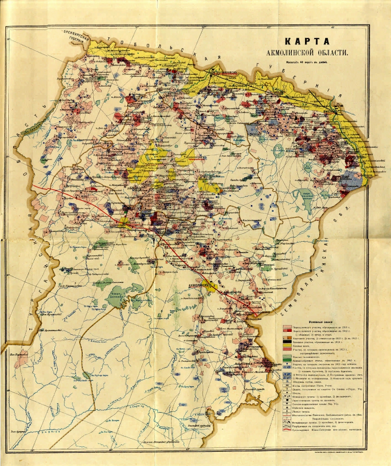
Akmola region. Map. [1: 168,000]. |
|
|
Map of Akmola region [Maps]: [with changes]. - [1: 168,000], 40 versts in inch (1, 7 km in 1 cm). - Petrograd: The cartographic institution A. Yakovenko, [1914]. - 1 in.: Color. ; 50х40 (57х45). -
Cartographic grid in 2 °.
Longitude from Pulkovo is fixed.
Without relief.
Conditional signs: relocated. areas of the Kirghiz, Kazakhs (data for 1913), wells, reservoirs, bridges, medical and veterinary stations, warehouses, etc.
A map from a copy of the Omsk HONB with the title of the cover: Maps [Siberia].
. |
|
1. Territory (collection). 2. Omsk region: pages of history (collection). 3. Territory of Russia: Omsk Region (collection). 4. Russia-Kazakhstan: from the history of relationships (collection). 5. Akmola region (Kazakhstan) - Geography - beginning. 20 cent. - Maps. 6. Geographic maps. |
ББК 26.89 (543) я64
|
Source of electronic copy: Omsk GONB
Location on
Омская ГОНБ; RK 912 (57) |
|